Adams Lake Waterfront Acreages
Listing Realtor


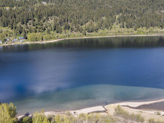
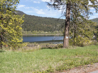
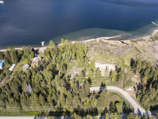
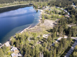
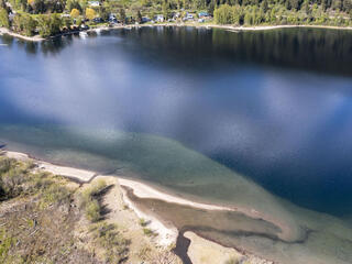
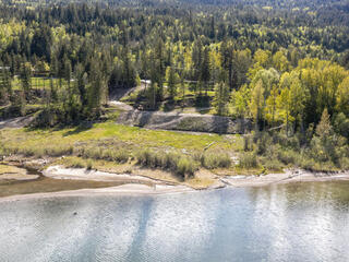
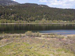
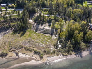
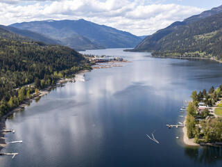
Adams Lake is the Shuswap 20 years ago, but shhhhh don’t tell anyone! There is very limited freehold waterfront on Adams Lake and these acreages are some of the only ones that haven’t been developed, especially at the south end of the lake. Not to mention they boast some of the best beach on the lake.
Adams really is a hidden gem with miles of untouched shoreline and much less traffic than the Shuswap. The crystal clear waters provide good fishing, boating and swimming. You even have the Adams River at your doorstep which provides fishing, rafting and is world-renowned for their Sockeye run in the fall. These aren't your only recreational playgrounds though - you have trails right out the back door for snowmobiling, quadding and whatever else your heart desires.
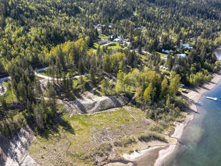
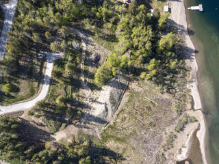
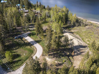
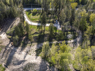
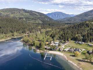
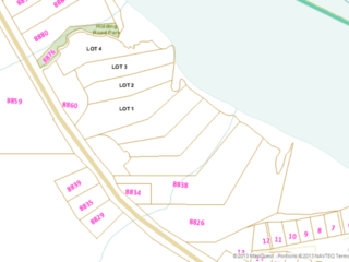
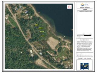
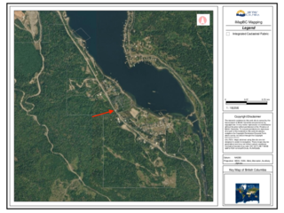
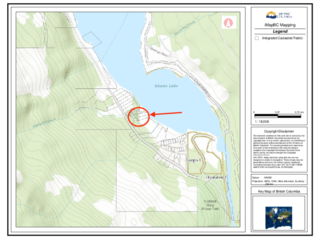
There is no timeline to build – hold onto this until you are ready to start that summer cottage or your dream home. This is a small strata with low monthly fees, common septic field and water license in place. These lots lie just past the Adams Lake Store and are spacious and sloped providing great views with mature trees for privacy. There are 4 lots available ranging from 1.1 - 1.8 acres in size, so call your family and friends!
Really these are a little piece of bliss and are listed well below the assessed values.
Lot 1: 1.791 acres: $395,000
Lot 2: 1.11 acres: $465,000
Lot 3: 1.232 acres: $465,000
Lot 4: 1.307 acres: $490,000
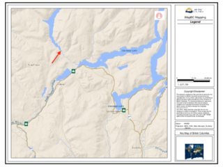
Adams Lake is a large, deep, coldwater lake in British Columbia; its average depth ranks 6th in the world. The southern end of the lake is approximately 30 km (19 mi) north of the town of Chase in the Shuswap region of BC. The lake's upper reaches lie in the northern Monashee Mountains, while its lower end penetrates the Shuswap Highland. The lake supports Chinook, Sockeye and Coho salmon, Kokanee, Mountain Whitefish and Bull, Lake and Rainbow Trout.
The lake is 63 km (39 mi) long and between 1.6 kilometres (0.99 mi) and 3.2 kilometres (2.0 mi) wide. The surface elevation is 404 metres (1,325 ft) above sea level. The lake is very deep; with a mean depth of 299 metres (981 ft) and maximum depth of 457 metres (1,499 ft) it is the second deepest lake in BC (next to Quesnel Lake, which has a maximum depth of 511 metres (1,677 ft)) and 6th deepest lake in the world by mean depth. Water flows into the lake though many tributaries (most notably the Upper Adams River, Momich River, and Bush Creek). The water drains from the lake as the Lower Adams River which is home to a very large and famous sockeye salmon run which attracts many visitors to the region each year. From there the water flows into Shuswap Lake, and down the Thompson River.
Though a few villages exist along Adams Lake, the vast majority of the lake is undeveloped. The lack of development is partially due to the nature of the shoreline, which is mostly sheer rock faces or steep, stony beaches. Few recreationally suitable beaches exist naturally on the lake, though some man-made sandy beaches have been created for public use, for example at Adams Lake Provincial Park.